


Airfield Mapping and Infrastructure Documentation
With over 20 years of experience in airfield management, we combine drone expertise and a commitment to safety to precise maintenance maps for airport managers. Our innovative solutions significantly reduce inspection time for Airport Managers while effectively tracking long-term discrepancies. Additionally, we provide comprehensive documentation for both Federal State projects, ensuring compliance and transparency in all operations.
Maps are flown using secure systems with no data transmitted overseas, and are affordable for a wide variety of airport operators. Contact us today to discuss products and pricing!

Low Resolution - Google Earth
Google Earth struggles to clearly identify potential airfield discrepancies, such as pavement deformation

High Resolution - Drone Imagery
Low Altitude Drone Imagery of the same area clearly shows pavement discrepancies (such as alligator cracking as seen here)

Google Earth View
While Google Earth has excellent features, the basemap imagery is not sufficient for tracking airfield issues, particularly at small airports with heavy work loads.

Drone Imagery
Drone-generated Orthomosaics are outstanding tools for tracking both pavement discrepancies and marking issues for Airport Managers.
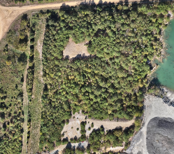
Obstacle Assessments
Drone Orthomosaics can also be helpful in tracking potential obstacles in the near-airport environment such as approach or departure paths.

Obstacle Planning
Combining the Drone Orthomosaic with Elevation Modeling can help maximize trees that need to be tracked or removed in order to maintain aviation safety while minimizing overhead costs.